Yerba Buena (Yerba Buena)
Yerba Buena is the capital of the Yerba Buena Department in the province of Tucumán, Argentina. It is located at an altitude of around 466 metres (1528 feet).
The city of Yerba Buena is the most urbanized area of the department. It is mostly residential, although commercial activity has increased along its main road (Aconquija Avenue) with different kind of shops, shopping arcades, restaurants, bars and cafés. The main avenue has is lively, especially on weekends, when yerbabuenenses and people from its neighboring cities gather in search of fun and relaxation.
Yerba Buena is home to most of the country clubs and gated communities in the province, although there are slums scattered around the city.
Yerba Buena is a city, possibly given its name because people there may be friendly. There is a place called San Javier in the mountains nearby where there is a large cross called "El Cristo" (The Christ). Yerba Buena has experienced more growth than any other Argentine city since 1996 with an average of two residences per day being constructed.
Because of being so close to San Miguel de Tucumán, Yerba Buena's only access is through Tucumán. Bus lines # 100, 102 and 118 embark every 5 minutes from San Miguel to Yerba Buena. Taxi services are also available. Yerba Buena has its own airport (Mauricio Gilli Aerodrome) for light and private aviation.
Map - Yerba Buena (Yerba Buena)
Map


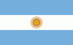
Country - Argentina
 |
 |
| Flag of Argentina | |
The earliest recorded human presence in modern-day Argentina dates back to the Paleolithic period. The Inca Empire expanded to the northwest of the country in Pre-Columbian times. The country has its roots in Spanish colonization of the region during the 16th century. Argentina rose as the successor state of the Viceroyalty of the Río de la Plata, a Spanish overseas viceroyalty founded in 1776. The declaration and fight for independence (1810–1818) was followed by an extended civil war that lasted until 1861, culminating in the country's reorganization as a federation. The country thereafter enjoyed relative peace and stability, with several waves of European immigration, mainly Italians and Spaniards, radically reshaping its cultural and demographic outlook; over 60% of the population has full or partial Italian ancestry, and Argentine culture has significant connections to Italian culture.
Currency / Language
| ISO | Currency | Symbol | Significant figures |
|---|---|---|---|
| ARS | Argentine peso | $ | 2 |
| ISO | Language |
|---|---|
| EN | English language |
| FR | French language |
| DE | German language |
| GN | Guarani language |
| IT | Italian language |
| ES | Spanish language |